WHO WE ARE
Civil Engineers
Landscape Architects
Land Surveyors
Providing innovative engineering and land development solutions
Now offering advanced drone and 3D laser scanning services to deliver fast, safe, and highly accurate reality capture for civil engineering and surveying applications.
Please feel free to explore our drone & 3D scanning services by clicking here.
OUR HISTORY
A Foundation Built Upon Decades of Diversified Experience
Serving eastern Pennsylvania, New Jersey, New York, Delaware, Maryland, Virginia, North Carolina, Florida, and Louisiana, Eustace participates in projects of all sizes — from single lot residential developments to multi-acre industrial parks and subdivisions. The experts at Eustace have the knowledge and experience to facilitate all projects from concept to completion.
OUR SERVICES
A Wide Range of Creative Engineering Capabilities
-
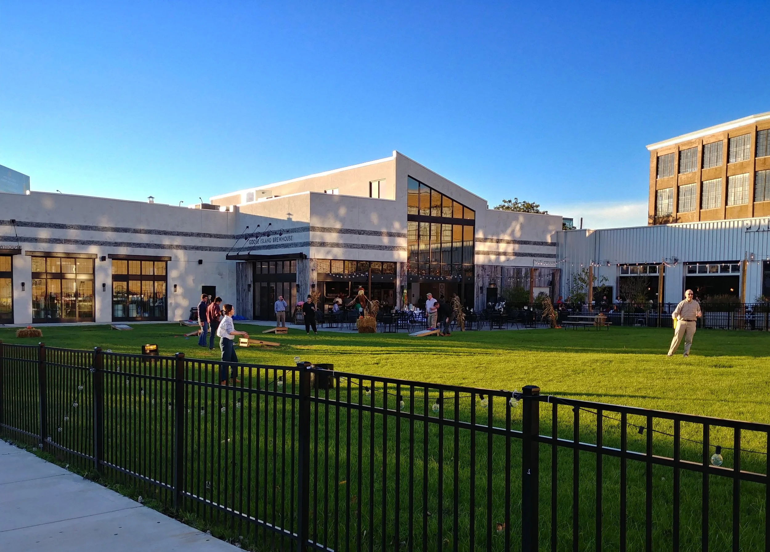
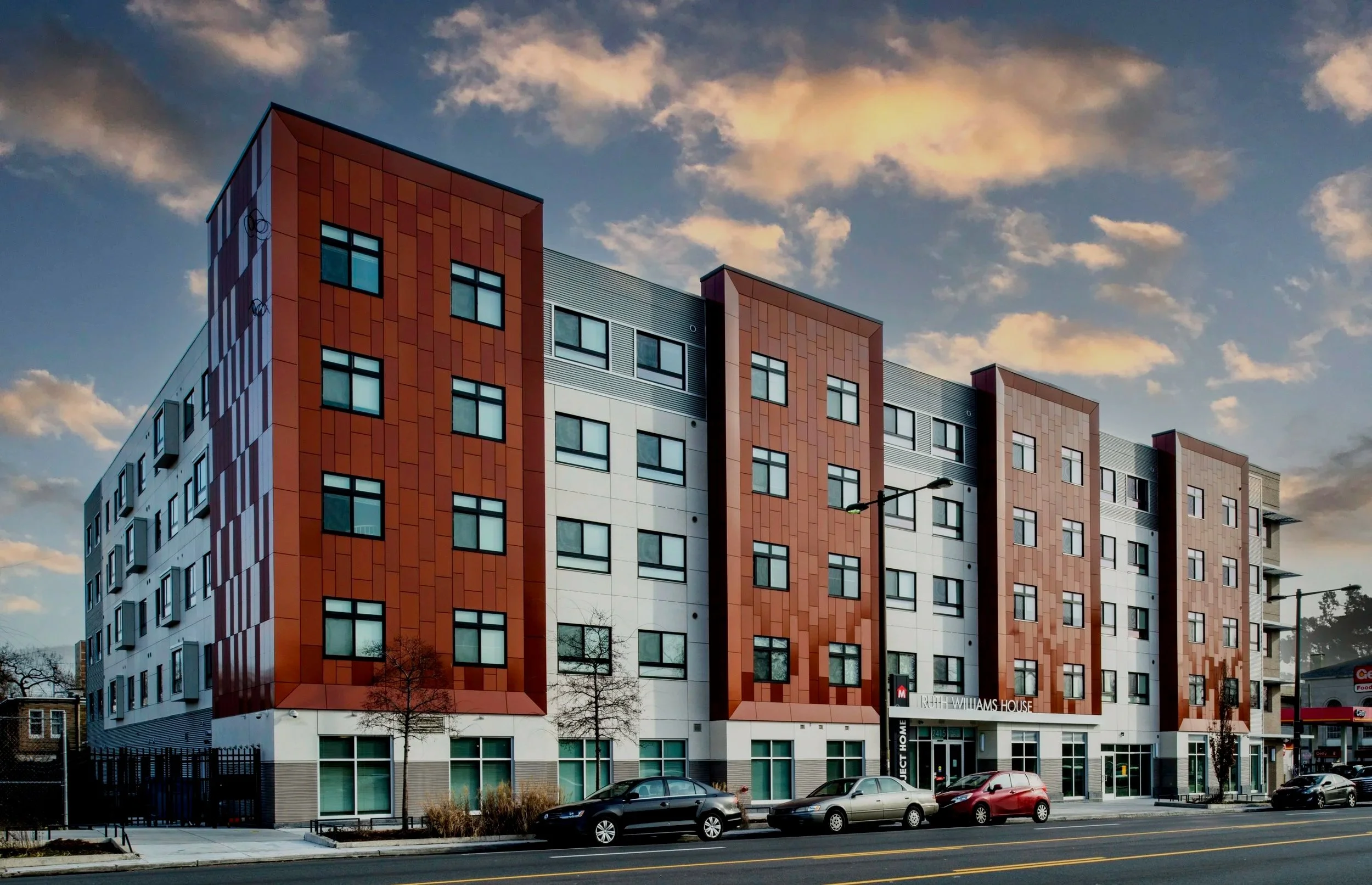
Site Civil Engineering
From site planning and infrastructure design to environmental and construction oversight, we provide practical, sustainable engineering solutions that enhance community living, support long-term resilience, and foster meaningful growth.
-
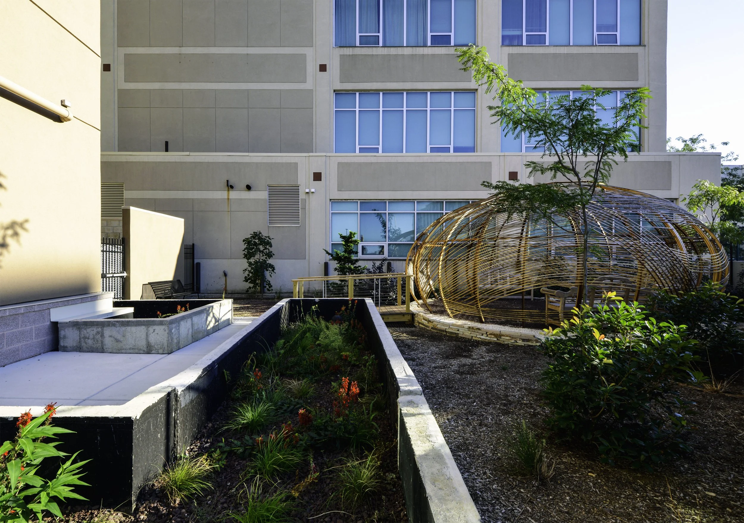
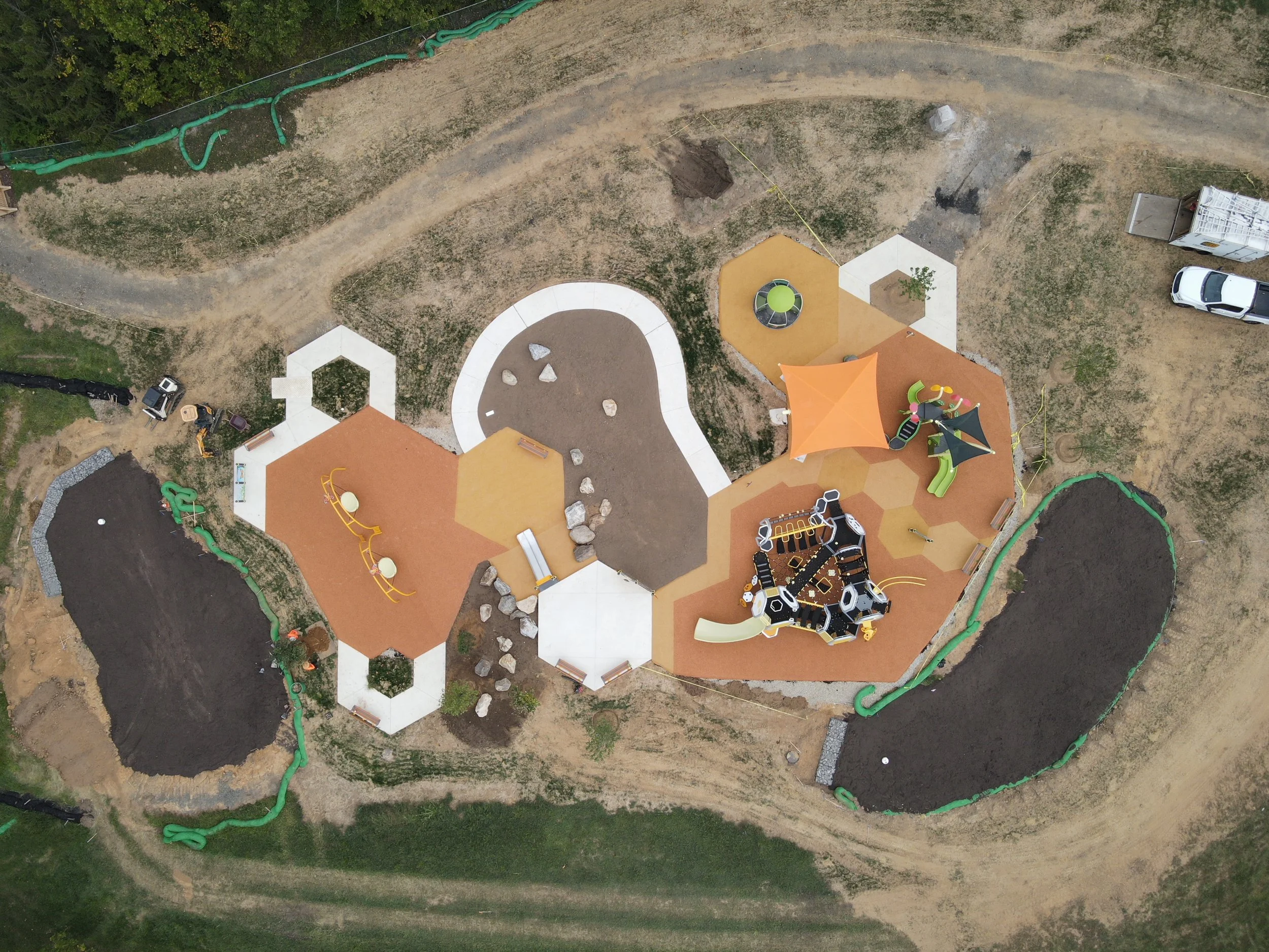
Landscape Architecture
Our design services blend creativity and functionality to craft inviting outdoor spaces. We create nature-harmonizing, sustainable, innovative designs—from urban parks to residential gardens—to bring your vision to life.
-
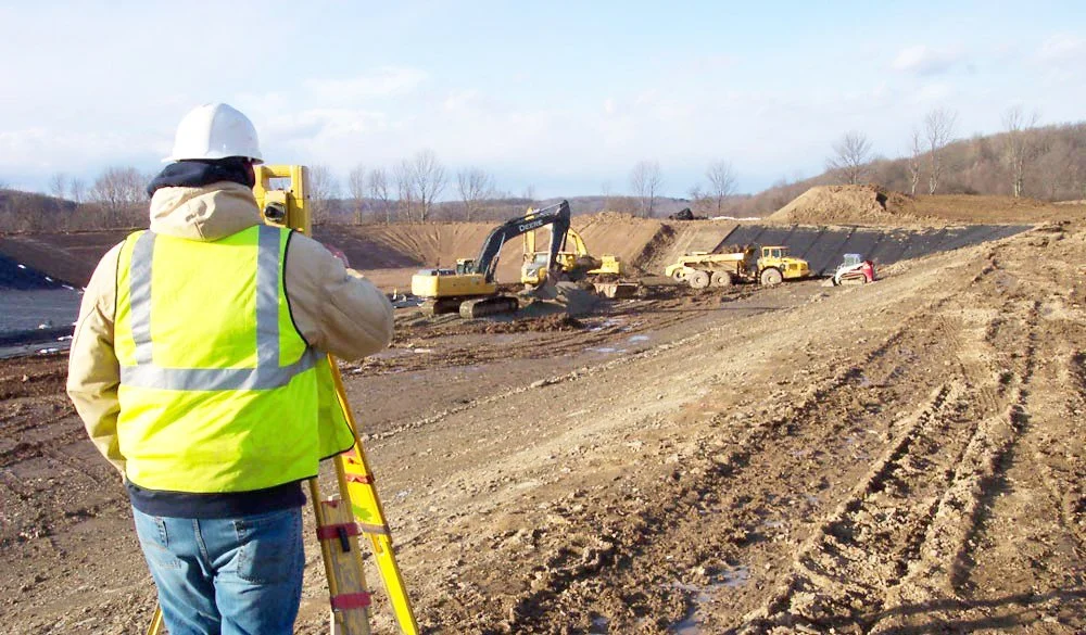
Land Surveying & Mapping
Our land surveying services provide a precise, dependable foundation for your projects. With advanced technology, we deliver accurate boundary surveys, topographic mapping, and essential data for informed development.
-
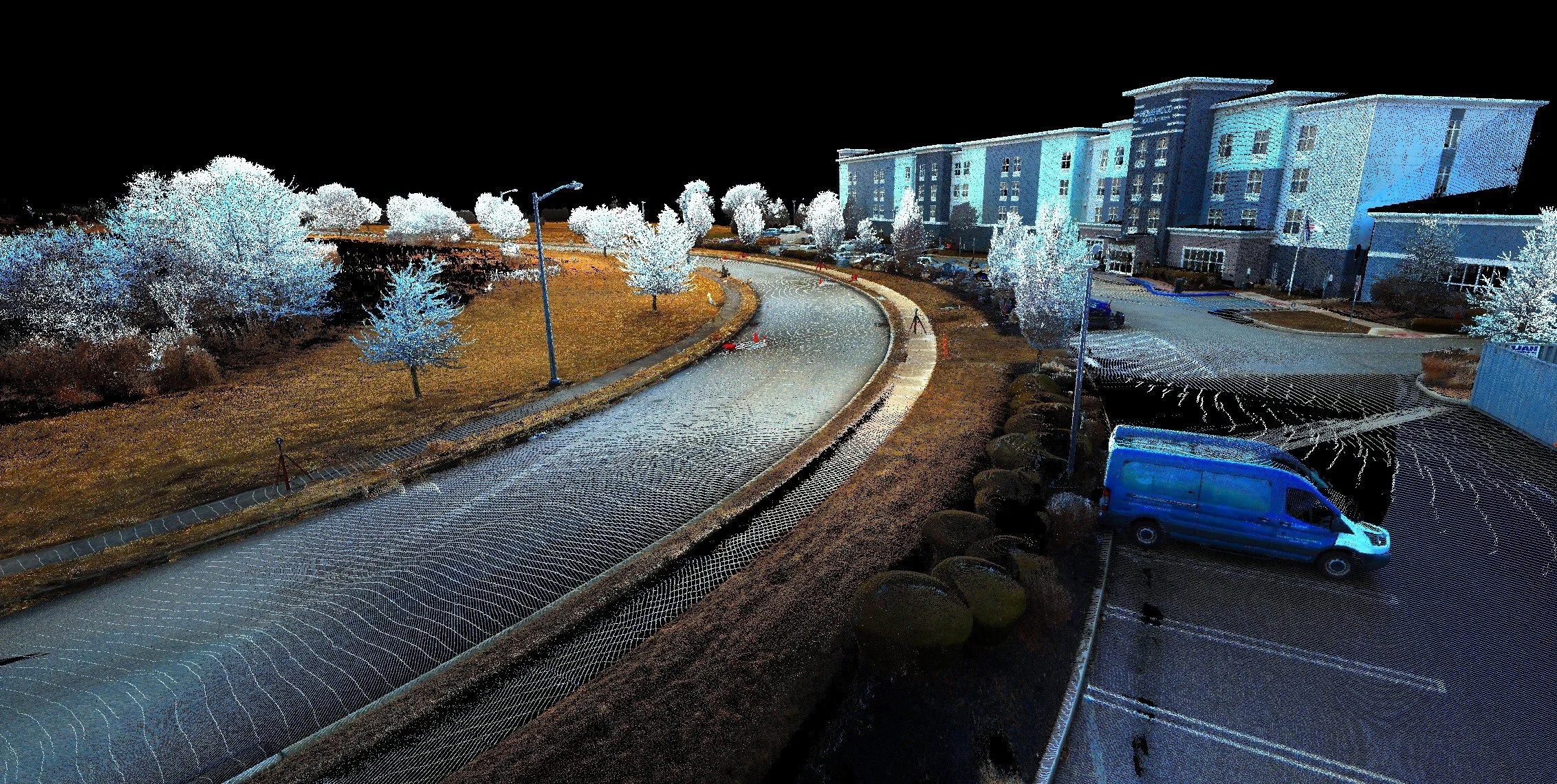
Drone (UAS) & 3D Scanning
Our drone operations utilize FAA Part 107-certified pilots and commercial-grade drones equipped with photogrammetry and LiDAR sensors, enabling accurate data capture, detailed imagery, and precise measurements for project needs.
WHY EUSTACE?
Create a Career with an Award-Winning Firm
Our mission is to become the best team in the area. Our staff’s diversity in background, knowledge, and expertise enables us to provide integrated designs. We pride ourselves in our ability to find solutions to challenging projects with innovative efficiency. Eustace Engineering is always interested in finding qualified employees to join our growing team of experts.